
Sea ice products
| Product | Identifier | Status | Satellite input | Level | Temporal coverage | Temporal sampling | Spatial coverage | Spatial sampling |
|---|---|---|---|---|---|---|---|---|
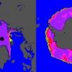
Near real time product
Global Sea-Ice Concentration (SSMIS)
|
OSI-401-d | Operational | DMSP/SSMIS | L3 | 2005-onwards | 1 per day | Global | 10 km |
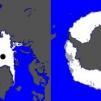
Near real time product
Global Sea-Ice Edge
|
OSI-402-d | Operational | GCOM-W/AMSR2 and Metop/ASCAT | L3 | 2005-onwards | 1 per day | Global | 10 km |
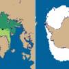
Near real time product
Global Sea-Ice Type
|
OSI-403-d | Operational | GCOM-W/AMSR2 and Metop/ASCAT | L3 | 2005-onwards | 1 per day | Global | 10 km |
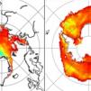
Near real time product
Sea-Ice Emissivity
|
OSI-404-d | Operational | GOSAT-GW/AMSR3 | L3 | 2018-onwards | 1 per day | Global | 10 km |
Near real time product
Global Low Resolution Sea-Ice Drift
|
OSI-405-d | Operational | GCOM-W/AMSR2 and Metop/ASCAT | L3 | 2009-onwards | 1 per day | Global | 62.5 km |
Near real time product
Global Sea-Ice Concentration (AMSR2)
|
OSI-408-a | Operational | GCOM-W/AMSR2 | L3 | 2016-onwards | 1 per day | Global | 10 km |
|
Near real time product
Sea-Ice Concentration (AMSR3)
|
OSI-408-g | Operational | GOSAT-GW/AMSR3 | L3 | 2016-onwards | 1 per day | Global | 10 km |
Near real time product
Level 2 PMW Sea-Ice Concentration
|
OSI-410-a | Operational | DMSP/SSMIS, GCOM-W1/AMSR2 | L2 | 2021-onwards | Up to 15 per day for each SSMIS, and up to 15 per day for AMSR2 | Global | SSMIS: 25 km, AMSR2: 10 km |
|
Near real time product
Level 2 PMW Sea-Ice Concentration
|
OSI-410-g | Operational | DMSP/SSMIS, GOSAT-GW/AMSR3 | L2 | 2021-onwards | Up to 15 per day for each SSMIS, up to 15 per day for AMSR3 | Global | SSMIS: 25 km, AMSR3: 10 km |
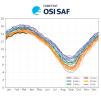
Climate product
Sea-Ice Index, version 3.0
|
OSI-420-a | Operational | SMMR, DMSP/SSM/I, DMSP/SSMIS, GCOM-W/AMSR2 | Indicator | 1978-onwards | Updated daily | Hemispherical and regional | |

|
OSI-430-a (complementing OSI-450-a1) | Suspended | DMSP/SSMIS from EUMETCast | L3+L4 | 2021-2025 | 24 h for the L3/L4 daily files. Monthly for the monthly files and indicator. | Global | 25 km |
|
OSI-435 (complementing OSI-455) | Demonstrational | SSMIS and AMSR2 | L3+L4 | 2021-2025 | 24 h | Global | 75 km |
|
|
OSI-438 (complementing OSI-458) | Operational | AMSR2 (JAXA) | L3+L4 | 2021-onwards | 24 h for the L3/L4 daily files. Monthly for the monthly files and indicator. | Global | 25 km |
|
|
OSI-438-a (complementing OSI-458 and OSI-438) | Operational | AMSR3 (JAXA) | L3+L4 | 2021-onwards | 24 h for the L3/L4 daily files. Monthly for the monthly files and indicator. | Global | 25 km |
|
OSI-450-a1 | Released | SMMR, SSM/I and SSMIS from CM SAF (FCDR R4) | L3+L4 | 1978-2020 | 24 h (before July 1987: 48 hours) | Global | 25 km |
|
Climate product
Global Low Resolution Sea-Ice Drift data record, release 1
|
OSI-455 | Released | SSM/I and SSMIS from CM SAF R4, AMSR-E (NSIDC) and AMSR2 (JAXA) | L3+L4 | 1991-2020 | 24 h | Global | 75 km |
|
|
OSI-458 | Released | ASMR-E (NSIDC) and AMSR-2 (JAXA) | L3+L4 | 2002-2020 | 24 h | Global | 25 km |
New ticket helpdesk