Radiative fluxes products
| Product | Identifier | Status | Satellite input | Level | Temporal coverage | Temporal sampling | Spatial coverage | Spatial sampling |
|---|---|---|---|---|---|---|---|---|
Near real time product
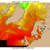
Atlantic High Latitude Downward Longwave Irradiance
|
OSI-301-c | Operational | Metop-B/AVHRR, Metop-C/AVHRR, NPP/VIIRS, NOAA-20/VIIRS | L3 | 2012-onwards | 1 per day | Atlantic Ocean north of 50N and parts of the Arctic Ocean (+/-90° from 0° longitude) | 5 km |
Near real time product
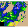
Atlantic High Latitude Surface Solar Irradiance
|
OSI-302-c | Operational | Metop-B/AVHRR, Metop-C/AVHRR, NPP/VIIRS, NOAA-20/VIIRS | L3 | 2012-onwards | 1 per day | Atlantic Ocean north of 50N and parts of the Arctic Ocean (+/-90° from 0° longitude) | 5 km |
Near real time product
Meteosat Downward Longwave Irradiance
|
OSI-303-a | Operational | Meteosat-10/SEVIRI | L3 | 2011-onwards | 24 per day + 1 per day | East Atlantic, West Indian: 60N-60S 60W-60E | 0.05° Lat-Lon |
Near real time product
Meteosat Surface Solar Irradiance
|
OSI-304-a | Operational | Meteosat-10/SEVIRI | L3 | 2011-onwards | 24 per day + 1 per day | East Atlantic, West Indian: 60N-60S 60W-60E | 0.05° Lat-Lon |

Near real time product
Meteosat Indian Ocean Downward Longwave Irradiance
|
OSI-IO-DLI | Demonstrational | Meteosat-9/SEVIRI | L3 | 2017-onwards | 24 per day + 1 per day | East Atlantic, West Indian: 60N-60S 18.5W-101.5E | 0.05° Lat-Lon |

Near real time product
Meteosat Indian Ocean Surface Solar Irradiance
|
OSI-IO-SSI | Demonstrational | Meteosat-9/SEVIRI | L3 | 2017-onwards | 24 per day + 1 per day | East Atlantic, West Indian: 60N-60S 18.5W-101.5E | 0.05° Lat-Lon |
New ticket helpdesk