 Licensed under CC BY 4.0 by EUMETSAT
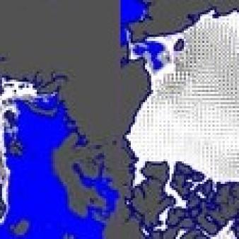
Global Low Resolution Sea Ice Drift
Operational Near real time productGridded sea-ice drift vector fields obtained from satellite image processing. It is a low resolution product (62. resolution). Ice motion vectors with a time span of 48 hours are estimated by an advanced cross-correlation method (the Continuous MCC, CMCC). Several single-sensor products are available, along with a merged (multi-sensor) dataset. This near-real-time product is intended for routine monitoring and data assimilation. For climate application, please use the OSI SAF sea-ice drift Climate Data Record (OSI-455).
EO:EUM:DAT:MULT:GBL-LR-SIDR
Displacement after 48 hours in km.
OSI SAF FTP server (last 31 days)
ftp://osisaf.met.no/prod/
Directory: ice/drift_lr/
OSI SAF FTP server (archive)
ftp://osisaf.met.no/archive/
Directory: ice/drift_lr/
OSI SAF Thredds
EUMETSAT Multicast
The product series is operational since 2009:
- version OSI-405 from 2009 to 2015
- version OSI-405-b from 2015 to 30/05/2017
- version OSI-405-c from 30/05/2017 to 04/03/2025
- version OSI-405-d from 04/03/2025
Whether you’re displaying the product as-is or if you have used it as input data, please use one of the following attribution:
Figures (short): "EUMETSAT OSI SAF OSI-405-d"
Texts (long): “Data source: EUMETSAT OSI SAF, Global Low Resolution Sea Ice Drift (2025), OSI-405-d, doi:10.15770/EUM_SAF_OSI_NRT_2007.”
Papers: “EUMETSAT Ocean and Sea Ice Satellite Application Facility, Global Low Resolution Sea Ice Drift (2025), OSI-405-d, doi:10.15770/EUM_SAF_OSI_NRT_2007.”
In 2017, a new variable, the product uncertainties, was introduced in the files for OSI-405-c: it provides an uncertainty value (aka expected accuracy) for each grid location, it holds the standard deviation of the uncertainty in the components of the ice drift displacement vectors.
In 2025, for OSI-405-d, the changes are mainly technical :
Please note also that OSI SAF products are licensed under the Creative Commons Attribution 4.0 International License (CC BY 4.0) by EUMETSAT. See OSI SAF usage policy and acknowledgement