 Licensed under CC BY 4.0 by EUMETSAT
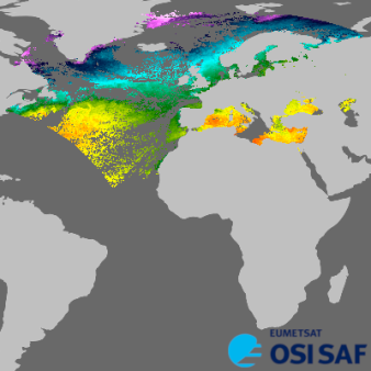
North Atlantic Regional Sea Surface Temperature
Operational Near real time productLevel 3, four times a day, sub-skin Sea Surface Temperature derived from AVHRR on Metop and VIIRS on NOAA, over North Atlantic and European Seas and re-projected on a polar stereographic at 2 km resolution, in GHRSST compliant netCDF format.
Identification
Acronym : NAR SST
Product navigator reference :
EO:EUM:DAT:MULT:OSSTNARN
OSI SAF producer : Météo-France
Identifier : OSI-202-c
Digital object identifier (DOI) 10.15770/EUM_SAF_OSI_NRT_2012
Acronym for EDC (APNM) : OSSTNARN
License/Attribution : See at bottom
Characteristics
Processing level : L3C
Satellite input : Metop-B/AVHRR and NOAA-20/VIIRS
Other input : ECMWF outputs (temperature, humidity and aerosols profiles)
Temporal sampling : 4 per day
Timeliness :
?
The timeliness is the time elapsing from the sensing time of the last contributing file to the product dissemination to users. It is similar to the latency.
6h
Spatial coverage : North Atlantic
Spatial sampling : 2 km
Projection : polar stereographic
File Formats : LML FTP Server (NetCDF4), EDC (NetCDF4), EDC (GRIB2), EUMETCast (NetCDF4)
Characteristics & methods : Subskin temperature; multispectral algorithm + use of NWP output
Data Access
Credentials for access to OSI SAF tools
For the FTP access, please use the username anonymous.
OSI SAF FTP (main, full archive)
Directory: ifremer/cersat/projects/osisaf/sst/l3c/north_atlantic/
OSI SAF backup FTP (last 7 days)
Directory: ifremer/cersat/projects/osisaf/sst/l3c/north_atlantic/
OSI SAF Thredds
EUMETSAT Multicast
Redistribution by PO.DAAC
Metop-B: https://podaac.jpl.nasa.gov/
NOAA-20:
Accuracy Requirements
Target accuracy : monthly absolute mean difference: 0,5 K, Sdt Deviation: 0,8 K
Verification/validation method : routine comparison with drifting buoy measurements
Applications and users
Usage : Atmosphere and ocean models
Oceanography and fisheries.
Oceanography and fisheries.
History
Authorised to be operational / released :
Declared operational / released since :
On EUMETCast since :
On EDC since :
On FTP server since :
Expected date for operational/released :
First date :
Full series temporal coverage : 2006-onwards
Detailed history :
The product series is operational since 2006
- version OSI-202 Metop-A and NOAA-18/NOAA-19 from 2006 to 2013
- version OSI-202-a Metop-A and NPP from 2013 to 2016
- version OSI-202-b Metop-B and NPP from 2016 to 2020
- version OSI-202-c Metop-B and NOAA-20 from 2020 onwards
By satellite:
- Metop-A 2008-2016 OSI-202
- Metop-B 2016-onwards OSI-202-b/OSI-202-c
- NOAA-17 2006-2010
- NOAA-18 2006-2012 OSI-202
- NOAA-19 2009-2013 OSI-202
- NPP 2013-2020 OSI-202-a/OSI-202-b
- NOAA-20 2020-ongoing OSI-202-c
License/Attribution
License/Attribution : Licensed under the Creative Commons Attribution 4.0 International License (CC BY 4.0) by EUMETSAT.
Whether you’re displaying the product as-is or if you have used it as input data, please use one of the following attribution:
Figures (short): "EUMETSAT OSI SAF OSI-202-c"
Texts (long): “Data source: EUMETSAT OSI SAF, North Atlantic Regional Sea Surface Temperature (2020), OSI-202-c, doi:10.15770/EUM_SAF_OSI_NRT_2012.”
Papers: “EUMETSAT Ocean and Sea Ice Satellite Application Facility, North Atlantic Regional Sea Surface Temperature (2020), OSI-202-c, doi:10.15770/EUM_SAF_OSI_NRT_2012.”
Comments
New ticket helpdesk

GHRSST identifiers (collection id):