 Licensed under CC BY 4.0 by EUMETSAT
Global Low Resolution Sea Ice Drift
Superseded Archived NRT productIce motion vectors with a time span of 48 hours are estimated by an advanced cross-correlation method (the Continuous MCC, CMCC) on pairs of satellite images. Several single-sensor products are available, along with a merged (multi-sensor) dataset.
Identification
Acronym : GBL LR SIDR
Product navigator reference :
EO:EUM:DAT:MULT:GBL-LR-SIDR
OSI SAF producer : Norwegian Meteorological Institute
Identifier : OSI-405-c
Digital object identifier (DOI) 10.15770/EUM_SAF_OSI_NRT_2007
Acronym for EDC (APNM) : OSIDRGB
License/Attribution : See at bottom
Characteristics
Processing level : L3
Satellite input : DMSP/SSMIS, Metop/ASCAT and GCOM-W/AMSR-2
Other input : ECMWF outputs
Temporal sampling : 1 per day
Central time : 12:00
Timeliness :
?
The timeliness is the time elapsing from the sensing time of the last contributing file to the product dissemination to users. It is similar to the latency.
6 h
Spatial coverage : Global
Spatial sampling : 62.5 km
Projection : Polar stereographic
File Formats : HL FTP Server (NetCDF3)
Characteristics & methods : Single and multi sensor analysis.
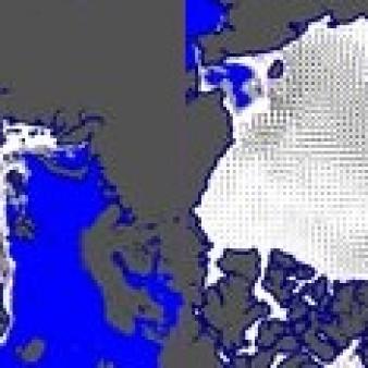
Displacement after 48 hours in km.
Displacement after 48 hours in km.
Data Access
OSI SAF FTP server (last 31 days)
ftp://osisaf.met.no/prod/
Directory: ice/drift_lr/
OSI SAF FTP server (archive)
ftp://osisaf.met.no/archive/
Directory: ice/drift_lr/
OSI SAF Thredds
EUMETSAT Multicast
Accuracy Requirements
Target accuracy : 5 km yearly std deviation on both x and y components after 48 hours displacement
Verification/validation method : Collocation with buoys
Applications and users
Usage : NWP and Ocean/Ice models, operational Met and Sea Ice services.
History
Authorised to be operational / released :
Declared operational / released since :
On EUMETCast since :
On EDC since :
On FTP server since :
First date :
Last date :
Full series temporal coverage : 2009-onwards
Detailed history :
The product series is operational since 2009:
- version OSI-405 from 2009 to 2015
- version OSI-405-c from 30/05/2017 to 04/03/2025
- version OSI-405-d from 04/03/2025
License/Attribution
License/Attribution : OSI SAF Global Low Resolution Sea Ice Drift, OSI-405-c, doi: 10.15770/EUM_SAF_OSI_NRT_2007. EUMETSAT Ocean and Sea Ice Satellite Application Facility. Data extracted from [distributor/distribution mean]: ([extracted period],) ([extracted domains],) accessed [download date]
The content within square brackets "[…]" is to be replaced with whatever distributor, period, domain or download date is relevant to the data being used. The "extracted period" and "extracted domains" are only needed if a subset of the data is being used.
Suggestions for "distributor/distribution mean": OSI SAF FTP server/the EUMETSAT Data Centre/EUMETCast/name and URL of a redistributor...
Comments
New ticket helpdesk

An new variable is introduced in the OSI-405-c NetCDF files : the product uncertainties. The new variable provides an uncertainty value (aka expected accuracy) for each grid location. In the case of OSI -405-c, the new variable holds the standard deviation of the uncertainty in the components of the ice drift displacement vectors.