 Licensed under CC BY 4.0 by EUMETSAT
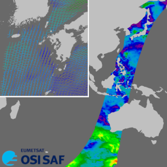
HY-2D 25 km wind vectors
Superseded Archived NRT productNear-real time level 2 ocean wind vectors on a 25 km swath grid, based on the backscatter measurements of the Chinese National Satellite Ocean Application Service (NSOAS) HY-2D/HSCAT scatterometer. Winds from the same instrument on HY-2B and HY-C are also processed by OSI SAF.
Identification
Acronym : HY2D25
Product navigator reference :
EO:EUM:DAT:0890
OSI SAF producer : Royal Netherlands Meteorological Institute
Identifier : OSI-116-a
Digital object identifier (DOI) 10.15770/EUM_SAF_OSI_NRT_2024
Acronym for EDC (APNM) : OHDSW025
License/Attribution : See at bottom
Characteristics
Processing level : L2
Satellite input : HY-2D/ HSCAT
Other input : NWP outputs (wind, SST, land-sea mask)
Central time : NA
Timeliness :
?
The timeliness is the time elapsing from the sensing time of the last contributing file to the product dissemination to users. It is similar to the latency.
25% of the data is available within 3 hours
Spatial coverage : Global
Spatial sampling : 25 km
Projection : Swath
File Formats : WIND FTP Server (BUFR), WIND FTP Server (NetCDF3), EDC (BUFR), EDC (NetCDF3), EUMETCast (BUFR)
Characteristics & methods : Measurements of the wind direction and wind speed above the sea surface, obtained through the processing of scatterometer data originating from the HSCAT instrument on NSOAS's Hai Yang 2D China's HaiYang-2D satellite.
Data Access
Credentials for access to OSI SAF tools
For the FTP access, you need credentials which are provided on request, after registration on OSI SAF web site.
OSI SAF FTP (last 3 days)
ftp://ftppro.knmi.nl/
Directory: hy2d
EUMETSAT Multicast
Accuracy Requirements
Target accuracy : For winds below 25 m/s, better than 2 m/s in wind component Stdev with an absolute mean difference of less than 0.5 m/s in wind speed on a monthly basis.
Verification/validation method : Triple collocation with NWP and buoys
Applications and users
Usage : * Operational Met Services (including assimilation in NWP models, nowcasting),
* Operational analyses and ocean models,
* Research or Environmental monitoring.
* Operational analyses and ocean models,
* Research or Environmental monitoring.
History
Authorised to be operational / released :
On EUMETCast since :
On EDC since :
On FTP server since :
Expected date for operational/released :
First date :
Last date :
Full series temporal coverage : 2023-onwards
Detailed history :
The product series is operational since 2023:
- version OSI-116-a (first version, pre-operational) from 09/11/2023 to 31/10/2024
- version OSI-116-c (second version, improved algorithm) from 31/10/2024 onwards
License/Attribution
License/Attribution : OSI SAF HY-2D 25 km wind vectors 2023-onwards, OSI-116-a. EUMETSAT Ocean and Sea Ice Satellite Application Facility. Data extracted from [distributor/distribution mean]: ([extracted period],) ([extracted domains],) accessed [download date]
The content within square brackets "[…]" is to be replaced with whatever distributor, period, domain or download date is relevant to the data being used. The "extracted period" and "extracted domains" are only needed if a subset of the data is being used.
Suggestions for "distributor/distribution mean": OSI SAF FTP server/the EUMETSAT Data Centre/EUMETCast/name and URL of a redistributor…
Comments
New ticket helpdesk

Note: Timeliness may improve depending on the number of data downloads through the ground station in Finland (or other polar ground stations).