What's up at the OSI SAF ?
-
We’ve decided to share this newsletter to report about what happens within the OSI SAF. We want to tell you more about our internal activities, our plans, the publications related to OSI SAF products. We would like to share with you some use cases to show you the various ways of using the products. There is content about winds, sea surface temperature, sea ice... just pick up what helps you.
-
Release of the wind user guides
The Wind Bias Correction Guide and the High Resolution Wind Data Assimilation Guide have been updated to reflect the latest insights on extreme winds, Numerical Weather Prediction errors, and the use of spatial Variational Bias Corrections. They are available on the NWP SAF website.
An other update is planned in the next months, if you still have unanswered question or comments after reading the current version, please tell us with an email to scat@knmi.nl
Latest publications with a link to OSI SAF wind products
See the web site for all publications
OSI SAF visiting scientist program
A visiting scientist activity has started in … to …
-
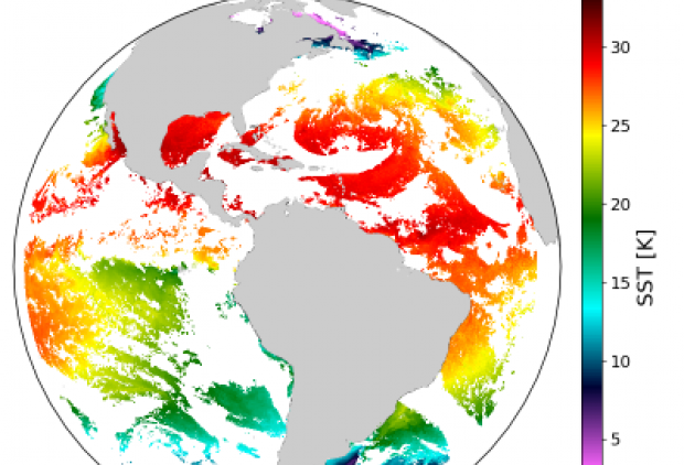
 Sea Surface Temperature from Low Earth Satellites
The OSI SAF global product and the regional one over Europe have been updated to replace the use of Metop-B by Metop-C and NPP by NOAA-20. It is planned to have the same change for HL Sea and Sea Ice Surface Temperature in the next months, we need to check the quality of the product before releasing it to users. If you are interested in being part of the review process before we officially release the products, don’t hesitate to contact us.
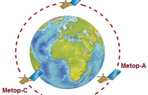 High Resolution SST from two Metop/AVHRR
Till a few months ago, the OSI SAF commited to process AVHRR data from one Metop satellite at a time, even if 3 Metops are currently flying. Following the request of a main user, the OSI SAF has now commited to process 2 Metops and to distribute the global AVHRR high resolution product (L2P) on the OSI SAF LML FTP server. Currently, the Metop-B and Metop-C MGR SST are distributed.
-
Sea Surface Temperature from Geostationnary Satellites
We have prepared and validated a new chain to process the new generation of geostationnary satellites (GOES and in the future MTG). This new chain enables:
-
the use of the full spatial resolution of input data from GOES-16, the first satellite of the 3rd generation of NOAA geostationnary satellites, to generate SST and radiative flux products
-
the implementation of an improved SST methodology, especially the bias correction parameterization, for MSG in 0°, for GOES-East and for MSG over the Indian Ocean.
-
-

Sea-ice concentration now available in high resolution
In addition to the two level 3 sea-ice concentration products produced daily by the OSI SAF, a level 2 product is now distributed. It is the first time a level 2 Passive Microwave Sea Ice Concentration is included in the OSI SAF porte-folio. It is based on AMSR-2 and SSMIS data. The files are delivered up to 15 times per day for each SSMIS satellite, and 30 times per day for AMSR-2.
In the AMSR-2 files, the results of two algorithms are provided : OSHD is the primary one recommended for operational systems and TUD is an experimental one. For the SSMIS files, only the OSHD algorithm is used.
You can read more about this in the product documentation : http://www.osi-saf.org/?q=content/level-2-pmw-sea-ice-concentration