 Licensed under CC BY 4.0 by EUMETSAT
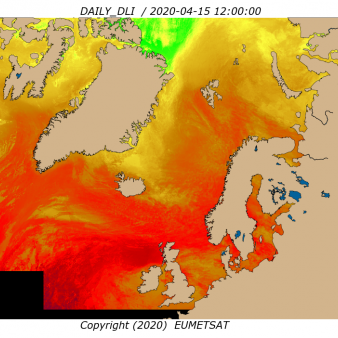
Atlantic High Latitude Downward Longwave Irradiance
Superseded Archived NRT productDaily Downward Longwave Irradiance over Atlantic High Latitudes based on AVHRR data from Metop and NOAA satellites.
Identification
Acronym : AHL DLI
Product navigator reference :
EO:EUM:DAT:0269
OSI SAF producer : Norwegian Meteorological Institute
Identifier : OSI-301-b
Acronym for EDC (APNM) : ODLISSIAHL
Characteristics
Processing level : L3
Satellite input : AVHRR (Metop, NOAA)
Other input : NWP outputs
Temporal sampling : 1 per day
Central time : 12:00
Timeliness :
?
The timeliness is the time elapsing from the sensing time of the last contributing file to the product dissemination to users. It is similar to the latency.
3h30
Spatial coverage : Atlantic North of 50N
Spatial sampling : 5 km
Projection : Polar Stereographic
File Formats : HL FTP Server (NetCDF4), EDC (NetCDF4), EUMETCast (NetCDF4)
Characteristics & methods : Bulk parameterization, including over sea ice
Data Access
Accuracy Requirements
Target accuracy : monthly relative absolute mean difference: 5 %, monthly relative standard deviation: 10 %
Verification/validation method : Comparison with pyrgeometers measurements
Applications and users
Usage : NWP, Ocean and biological modeling at operational and research centers.
History
Authorised to be operational / released :
Declared operational / released since :
On EUMETCast since :
On EDC since :
On FTP server since :
First date :
Last date :
Comments
New ticket helpdesk
This product superseded OSI-301.
Main differences with OSI-301 are
• the algorithm improvement, including over sea ice: new cloud type product from PPS v2014 (instead of v2009) and improved surface coefficients,
• processing on swath data instead of fixed tiles,
• the new output format (DLI and SSI combined in NetCDF4).
At the beginning of 2020, the data used are the AVHRR data from Metop-A, Metop-B and NOAA-19.