11/10/2023
Explore OSI SAF products on EUMETView
-
Blended Global Sea Ice Concentration Climate and Interim Climate Data Records for Northern Hemisphere – DMSP layer is now available on EUMETView.
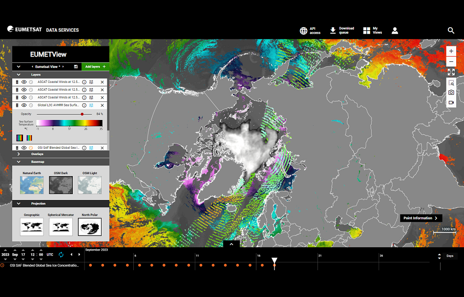
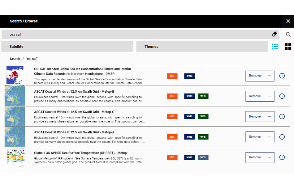
This addition to the EUMETview portal makes it now possible to view 3 types of OSI SAF product datasets on the platform. Users can combine information about Sea Ice, Sea Surface Winds and Sea Surface Temperature in the Nothern Hemisphere. This story present you how to access EUMETView and visualize OSI SAF data on the platform.
Give it a try !
EUMETView
-
EUMETView is a web-based application that provides access to a wide range of satellite imagery and products. It allows users to view and interact with various meteorological and environmental data collected by satellites. https://view.eumetsat.int/
-
EUMETSAT (European Organisation for the Exploitation of Meteorological Satellites) operates a service called EUMETView. EUMETView is a web-based application that provides access to a wide range of satellite imagery and products. It allows users to view and interact with various meteorological and environmental data collected by satellites.
Key features of EUMETView include:
- Satellite Imagery: Users can access near-real-time and archived satellite imagery from various Earth observation satellites operated by EUMETSAT, including those in the Meteosat and Metop series.
- Product Visualization: The platform provides access to a variety of meteorological and environmental products derived from satellite data. These products include information on cloud cover, precipitation, atmospheric composition, and more.
- Geographical Coverage: EUMETView covers various geographical regions, allowing users to focus on specific areas of interest.
- Customization: Users can customize their view by selecting specific satellite channels, products, and layers. This flexibility allows for a tailored analysis of meteorological conditions.
- Time Animation: EUMETView allows users to animate satellite imagery over time, providing a dynamic view of how weather patterns evolve.
- Data Download: Users can download satellite imagery and products for further analysis or use in other applications.
EUMETView is a valuable tool for meteorologists, researchers, and anyone interested in monitoring and studying Earth's atmospheric conditions. It contributes to the understanding of weather patterns, climate, and environmental changes. Access to EUMETView is free, and the platform is accessible to the public.
Users can visit the official EUMETSAT website for more information and access to the service. https://view.eumetsat.int/
-
OSI SAF Blended Global Sea Ice Concentration Climate and Interim Climate Data Records for Northern Hemisphere
Sea Ice Concentration
The available Sea Ice Concentration Layer is called "OSI SAF Blended Global Sea Ice Concentration Climate and Interim Climate Data Records for Northern Hemisphere - DMSP"
This layer is the blended version of the Global Sea Ice Concentration Climate Data Record (OSI-450-a) and Global Sea Ice Concentration Interim Climate Data Record (OSI-430-a) for the Northern Hemisphere. The sea ice concentration is computed from the SMMR (1978-1987), SSM/I (1987-2008), and SSMIS (2006-2020) instruments, as well as ECMWF ERA5. The layer includes the daily averaged fractional ice cover in percentage.
-
You can reach the layer using this link: https://view.eumetsat.int/productviewer?v=mumi:osi_sic_cdr_v3_nh#.
Given the nature of most EUMETView layers, the above link will show the layer in Plate Carrée, but you can choose another projection under the “projection” section, on the left side on the screen, like in the above view: https://view.eumetsat.int/productviewer?v=3335
-
The addition of OSI SAF Blended Global Sea Ice Concentration Climate and Interim Climate Data Records for Northern Hemisphere – DMSP layer on EUMETView makes it possible to visualize 3 types of OSI SAF product datasets on the platform. Users can now combine information about Sea Ice, Sea Surface Winds and Sea Surface Temperature in the Nothern Hemisphere.
-
Global L3C AVHRR Sea Surface Temperature (GHRSST) - Metop
Sea Surface Temperature
The available Sea Surface Temperature Layer is called "Global L3C AVHRR Sea Surface Temperature (GHRSST)"
Global Metop/AVHRR sub-skin Sea Surface Temperature (GBL SST) is a 12 hourly synthesis on a 0.05° global grid. The product format is compliant with the Data Specification (GDS) version 2 from the Group for High Resolution Sea Surface Temperatures (GHRSST).
-
ASCAT Coastal Winds at 12.5 km Swath Grid
Sea Surface Winds
The available Sea Surface Winds Layers are "ASCAT Coastal Winds at 12.5 km Swath Grid from Metop-A, -B & -C"
The winds correspond to an equivalent neutral 10m winds over the global oceans, with specific sampling to provide as many observations as possible near the coasts. This product can be downloaded as numerical data in EUMETView, where it is provided through a Web Feature Service (WFS).
-
Try it out yourself !
- Connect to https://www.eumetsat.int/eumetview
- Search for OSI SAF in the available layers
- Play around with the geographical projection and time steps.


